


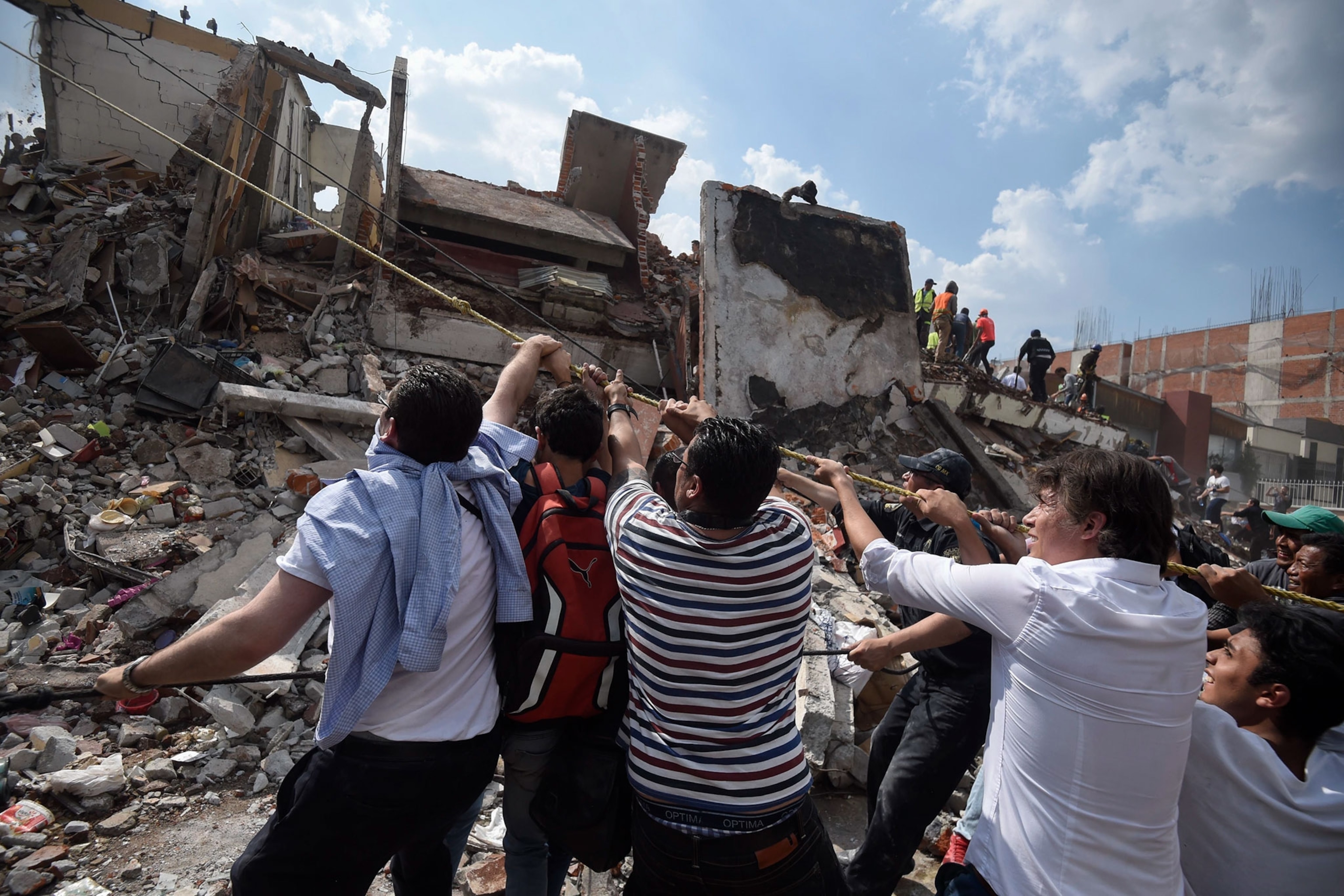

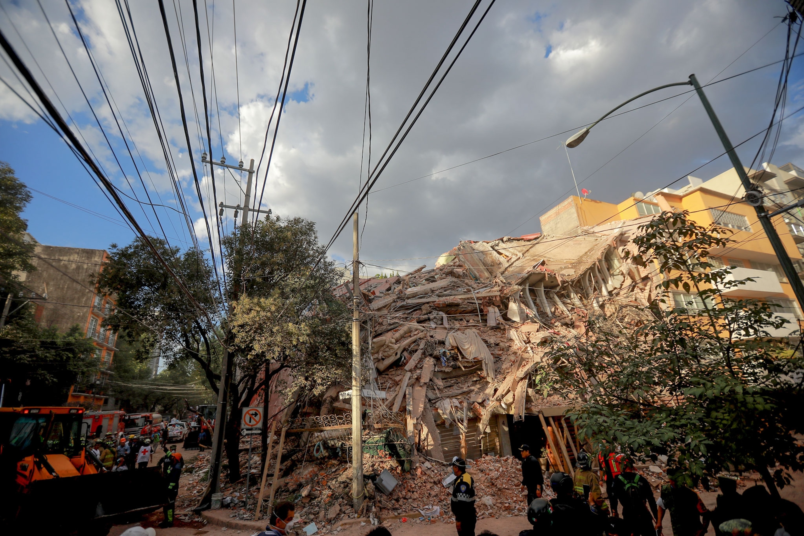


Destruction and Heartbreak as Mexico Reels From Earthquake
Swaying buildings and stunned faces were captured in photo and video moments after the quake struck.
This afternoon, Mexico City was rocked by a 7.1 magnitude earthquake.
Initial damage from the earthquake was not immediately clear, but in a Tweet, Mexican President Enrique Peña Nieto stated that the country's National Emergency Committee was dispatched to assess the situation.
Videos posted on social media show people huddled together in buildings and flooding into the streets as structures sway and even collapse.
According to the U.S. Geological Survey, the epicenter of the earthquake took place in Raboso, Mexico—about 75 miles south of the capital city.
Almost nine million people live in Mexico City. That's more than New York City and more than double the amount of people that live in Los Angeles. Initial death and injury reports had not been released at the time of this article's publication.
According to Diane Noserale, a public information specialist with the USGS, the quake happened too far inland for a tsunami to be triggered by the tremors. While the region is safe from the deadly waves that follow coastal earthquakes, the tremors themselves have been known to cause massive destruction.
Today's quake comes on the heels of an 8.1 magnitude earthquake that hit Chiapas, Mexico nearly a week ago leaving at least 90 dead and 32 years after a massive earthquake left thousands dead in the Mexico City area on September 19 in 1985.
The USGS runs an automated system called PAGER that predicts economic losses and fatalities based on a region's quake and surrounding infrastructure. PAGER predicted anywhere from 100 to 1,000 fatalities could result in the southeastern portion of the country as a result of Tuesday's earthquake.
Mexico is one of the most seismically active regions in the world. Three different tectonic plates are under different parts of Mexico, but most of the country is atop the westward moving North American plate. As the Pacific Ocean floor moves eastward, it's subducted under the continental plate, creating a trench along the south coast of Mexico.
According to a report from the USGS, the westward movement of this plate slows as a result of this convergence, resulting in earthquakes along the southern coast. Thousands of years ago, this movement created the region's southern mountains and volcanoes.
The North American plate extends from Mexico to the southern Arctic above Alaska. As a result, the U.S. west coast is also susceptible to earthquakes. A 3.2 magnitude earthquake was recorded near Los Angeles early this morning, but no cause-and-effect exists between the two seismic events.
Related Topics
You May Also Like


Go Further
Animals
- Why this rhino-zebra friendship makes perfect senseWhy this rhino-zebra friendship makes perfect sense
- When did bioluminescence evolve? It’s older than we thought.When did bioluminescence evolve? It’s older than we thought.
- Soy, skim … spider. Are any of these technically milk?Soy, skim … spider. Are any of these technically milk?
- This pristine piece of the Amazon shows nature’s resilienceThis pristine piece of the Amazon shows nature’s resilience
Environment
- This pristine piece of the Amazon shows nature’s resilienceThis pristine piece of the Amazon shows nature’s resilience
- Listen to 30 years of climate change transformed into haunting musicListen to 30 years of climate change transformed into haunting music
- This ancient society tried to stop El Niño—with child sacrificeThis ancient society tried to stop El Niño—with child sacrifice
- U.S. plans to clean its drinking water. What does that mean?U.S. plans to clean its drinking water. What does that mean?
History & Culture
- Séances at the White House? Why these first ladies turned to the occultSéances at the White House? Why these first ladies turned to the occult
- Gambling is everywhere now. When is that a problem?Gambling is everywhere now. When is that a problem?
- Beauty is pain—at least it was in 17th-century SpainBeauty is pain—at least it was in 17th-century Spain
- The real spies who inspired ‘The Ministry of Ungentlemanly Warfare’The real spies who inspired ‘The Ministry of Ungentlemanly Warfare’
- Heard of Zoroastrianism? The religion still has fervent followersHeard of Zoroastrianism? The religion still has fervent followers
Science
- Here's how astronomers found one of the rarest phenomenons in spaceHere's how astronomers found one of the rarest phenomenons in space
- Not an extrovert or introvert? There’s a word for that.Not an extrovert or introvert? There’s a word for that.
- NASA has a plan to clean up space junk—but is going green enough?NASA has a plan to clean up space junk—but is going green enough?
- Soy, skim … spider. Are any of these technically milk?Soy, skim … spider. Are any of these technically milk?
- Can aspirin help protect against colorectal cancers?Can aspirin help protect against colorectal cancers?
Travel
- What it's like to hike the Camino del Mayab in MexicoWhat it's like to hike the Camino del Mayab in Mexico
- Follow in the footsteps of Robin Hood in Sherwood ForestFollow in the footsteps of Robin Hood in Sherwood Forest
- This chef is taking Indian cuisine in a bold new directionThis chef is taking Indian cuisine in a bold new direction
- On the path of Latin America's greatest wildlife migrationOn the path of Latin America's greatest wildlife migration
- Everything you need to know about Everglades National ParkEverything you need to know about Everglades National Park
