
See a Century of National Parks Maps From Our Archives
Since 1912, National Geographic magazine has published over 100 maps of the national parks. Here are some of the most arresting.
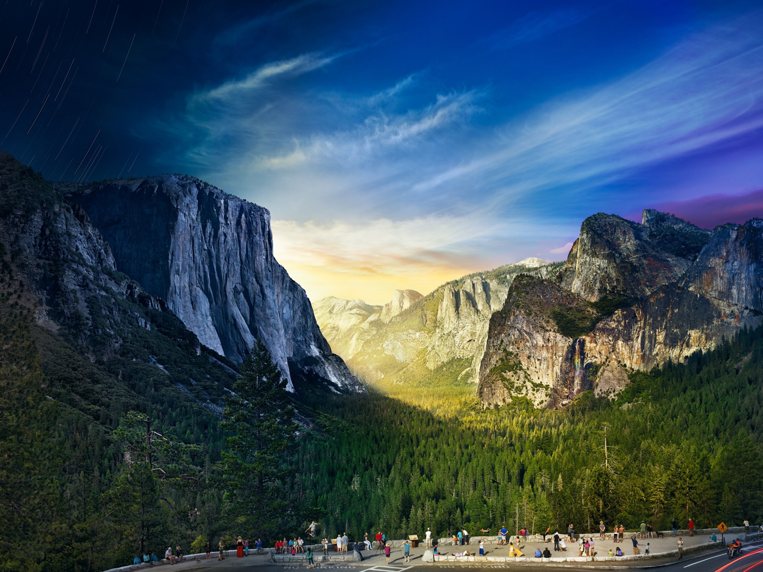
In National Geographic’s June 1912 issue, the historian Laurence F. Schmeckebier wrote of the national parks, “Within these great reserves may be found scenery and natural phenomena that are unequaled in their majesty and grandeur.” Published four years before the National Park Service was established on August 25, 1916, his article was accompanied by the magazine’s first map of the national parks, which spanned eleven states at the time.


Schmeckebier’s description captures the essence of what draws people to the national parks, and also what makes them such enticing subjects for cartographers. “It's a concentration of fascinating things in an area that people can visit,” says Debbie Gibbons, a cartographic director at National Geographic. That geographic concentration also makes them very mappable, she says. “They also generally have pretty stunning relief, so the maps are usually visually quite appealing.”
On the anniversary of the National Park Service’s founding, we’re looking back at some of our favorites from among more than 100 maps of parks that have appeared in the pages of National Geographic over the past century. Maps from the early and mid-twentieth century were mostly intended to show readers the geography of the parks and locate all the specific locations mentioned in the accompanying articles, which were usually something like a cross between a travel narrative and a guidebook.

In an article on Yellowstone from December 1956, for example, the explorer and National Geographic scientist Paul Zahl (who would discover the world’s tallest tree in California in 1963) wrote, “The closest I got to a bear was while tracking buffalo in the Hayden Valley, a prairie-like basin through which the Yellowstone River winds.” The map of the park accompanying the article shows a bear in the Hayden Valley.


Other maps were designed to help the telling of a story, such as the beautiful relief map of Mount McKinley National Park (known today as Denali National Park) in the August 1953 issue, which appeared with an article by the renowned National Geographic explorer Bradford Washburn about his successful first ascent of the mountain by a new route. The map was the first large-scale map ever created of the mountain, based on surveys and aerial photos taken by Washburn during the expedition.
More recently, maps of national parks in the magazine craft their own story, says Gibbons, bringing to life complex geographical concepts in a way text can’t.
A map of Yellowstone from May 2016 is an example that stands out, Gibbons says. It tells the story of the migration patterns of the park’s elk herds based on historical references, archaeological evidence, place names that refer to elk, and information about predatory wolves and humans. The cartographers used variations in color, brightness, and line thickness to illustrate the animals’ complex movements.
“These days when we create maps we try to evoke the feeling of the place as much as we can,” Gibbons says. And the national parks lend themselves to this mission particularly well. “They have such a richness in a single place,” she says. “There's nothing else that's really comparable.”
Betsy Mason and Greg Miller are authors of the forthcoming illustrated book from National Geographic, All Over the Map. Follow the blog on Twitter and Instagram.
Stay tuned for more stories about National Geographic’s editorial map archive here on All Over the Map. And see a different map from the archive every day by following @NatGeoMaps on Twitter, Instagram, and Facebook.
Related Topics
You May Also Like


Go Further
Animals
- Soy, skim … spider. Are any of these technically milk?Soy, skim … spider. Are any of these technically milk?
- This pristine piece of the Amazon shows nature’s resilienceThis pristine piece of the Amazon shows nature’s resilience
- Octopuses have a lot of secrets. Can you guess 8 of them?
- Animals
- Feature
Octopuses have a lot of secrets. Can you guess 8 of them?
Environment
- This pristine piece of the Amazon shows nature’s resilienceThis pristine piece of the Amazon shows nature’s resilience
- Listen to 30 years of climate change transformed into haunting musicListen to 30 years of climate change transformed into haunting music
- This ancient society tried to stop El Niño—with child sacrificeThis ancient society tried to stop El Niño—with child sacrifice
- U.S. plans to clean its drinking water. What does that mean?U.S. plans to clean its drinking water. What does that mean?
History & Culture
- Gambling is everywhere now. When is that a problem?Gambling is everywhere now. When is that a problem?
- Beauty is pain—at least it was in 17th-century SpainBeauty is pain—at least it was in 17th-century Spain
- The real spies who inspired ‘The Ministry of Ungentlemanly Warfare’The real spies who inspired ‘The Ministry of Ungentlemanly Warfare’
- Heard of Zoroastrianism? The religion still has fervent followersHeard of Zoroastrianism? The religion still has fervent followers
- Strange clues in a Maya temple reveal a fiery political dramaStrange clues in a Maya temple reveal a fiery political drama
Science
- NASA has a plan to clean up space junk—but is going green enough?NASA has a plan to clean up space junk—but is going green enough?
- Soy, skim … spider. Are any of these technically milk?Soy, skim … spider. Are any of these technically milk?
- Can aspirin help protect against colorectal cancers?Can aspirin help protect against colorectal cancers?
- The unexpected health benefits of Ozempic and MounjaroThe unexpected health benefits of Ozempic and Mounjaro
- Do you have an inner monologue? Here’s what it reveals about you.Do you have an inner monologue? Here’s what it reveals about you.
Travel
- Follow in the footsteps of Robin Hood in Sherwood ForestFollow in the footsteps of Robin Hood in Sherwood Forest
- This chef is taking Indian cuisine in a bold new directionThis chef is taking Indian cuisine in a bold new direction
- On the path of Latin America's greatest wildlife migrationOn the path of Latin America's greatest wildlife migration
- Everything you need to know about Everglades National ParkEverything you need to know about Everglades National Park
