Firefighters across California are battling massive wildfires that have scorched more than 3.5 million acres this year so far—a record-breaking fire season with months left to go. Hundreds of thousands of people have been forced to evacuate their homes and dozens have died in this year’s fire season, while more than 7,000 structures have been destroyed.
Smoke from these wildfires has grown so dense at times that it blocks out the sun—turning skies an eerie orange. More troubling, wildfire smoke is also associated with respiratory and cardiovascular illnesses, and has been shown to decrease lung function for years after it clears. (How breathing wildfire smoke affects the body.)
California-based photographer Stuart Palley is documenting the devastating effects of these fires throughout the state. As a qualified wildland firefighter who has photographed more than 100 fires throughout the state, Palley says he’s watched them get continuously worse over the years. But, he adds, he’s never seen a fire season quite like this one. “It’s a fire siege,” he says.
But Palley says these historic fires are actually the predictable outcome of a collision of factors. As more and more people build homes in the state’s fire-prone areas, firefighters must suppress fires in regions they once might have allowed to burn as a natural part of forest life. This ultimately preserves the trees and vegetation that will serve as fuel for the next, possibly even bigger, fire.
Meanwhile, climate change is making the land hotter and drier—and more flammable than ever before. “So, even in the absence of strong wind, the fires are just explosive up and down the state,” Palley says.
The intensity of the wildfires is taking a toll on the people who battle them. Palley says the firefighters are exhausted after battling blazes, some of them for two weeks straight with just short breaks.
Despite his extensive experience photographing wildfires, Palley says the fires’ unexpected intensity is changing the way he works—whether by using a particulate respirator mask rather than a cloth across his face, or by taking photographs from a safe distance using a long lens. “I’ve had to step back and be much more conservative,” he says. “There’ve been cases the fires have been so intense and so active, I don’t even get close to it.”
Palley took the following photos over the past weeks since the California wildfire season began in earnest, documenting the various fires and the damage they have wrought.
October 1

The Glass Fire rages unchecked through Napa and Sonoma counties, burning 51,266 acres to date. Many structures were damaged or leveled by the fire, fed by dry fuels and north winds. Wineries and vineyards have been destroyed, gutting a major driver of the regional economy.

September 30
Gold Ridge Fire Battalion Chief Gino DeGraffenreid leads a team fighting the Glass Fire.

September 20

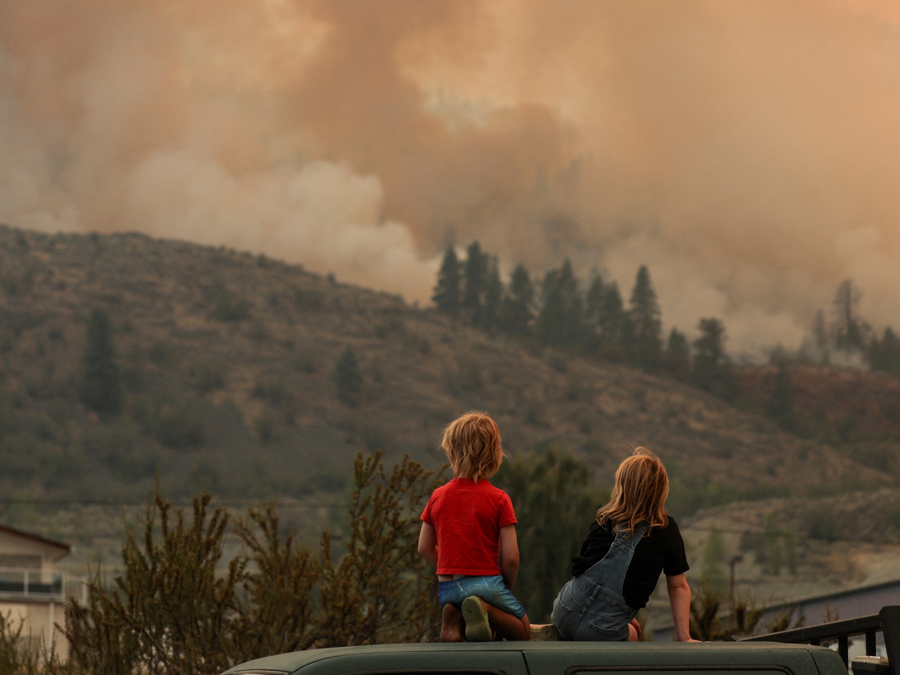
The Bobcat Fire burns in the Angeles National Forest. The fire encompassed 105,000 acres as of the evening. Major fire activity was threatening historic Mt. Wilson Observatory. Dozens of fire engines raced to the area to protect the historic 100-inch telescope.
MaryAnne Shiavello (left) and her grandson, Joseph Schiavello, 7, look on at the Bobcat Fire as it rages into the high desert near Pinon Hills, California, in Los Angeles County. One of MaryAnne’s sons lost his home that day in the fire. This wildfire was one of the largest in Los Angeles County's history.

September 18
The El Dorado Fire burns the San Bernardino National Forest in the early hours. Dry undergrowth and strong winds caused the fire to flare up.

September 15
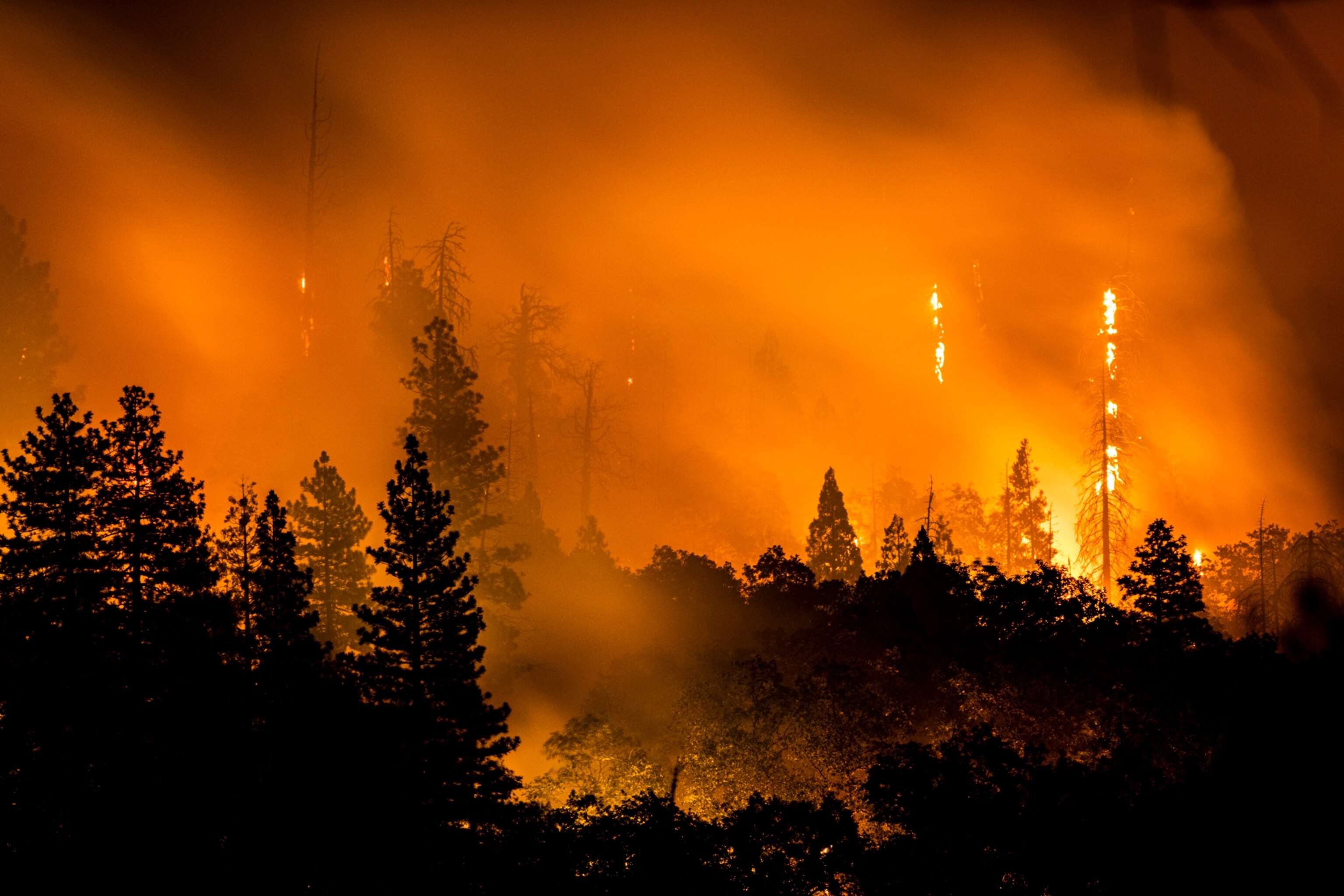
The Creek Fire burns in the Sierra National Forest northeast of Fresno. Experts speculated that a fire-induced tornado also occurred in some areas, given the treeless, moon-like landscape that they found.

September 13

The Fulton Hotshots from the U.S. Forest Service fight the Castle Fire by cutting through brush in the Sequoia National Forest, trying to hold the fire at the road overnight.
As of Sunday evening the Castle Fire covered 89,000 acres and was just 12 percent contained. Crews were trying to save the town of Camp Nelson. Various Sequoia groves were also being impacted, in addition to radio towers and a historic fire lookout.


September 11

Dwayne Bullette, an inmate at the Valley View Conservation Camp, watches for embers blowing over a fireline at the Bear Fire near Berry Creek. Prison inmate crews are a vital component of Cal Fire's firefighting efforts. Here, Cal Fire succeeded in protecting the historic Bloomer Hill fire lookout, built in 1925, from the flames, along with a critical radio tower. But the town of Berry Creek was destroyed.
A stump burns near the Bear Fire. The fire is part of the North Complex, a series of lighting fires that started in August, and that exploded during powerful winds in early September. Cal Fire estimated that approximately 2,000 structures were destroyed.

September 10

All that remained of Berry Creek was the general store and gas station. The rest of the area was completely burned. Trees were “flash frozen” into place, with leaves and pine needles burned into the direction of where they were blowing in the wind, indicating strong winds in advance of the extremely hot fire.


Lake Oroville and the Loafer Creek Boat Launch create an eerie foreground to a smoke-filled sky. Oroville, the seat of Butte County, was threatened by flames from the gigantic North Complex fire, which has pushed air quality into extremely unhealthy territory.
Exhausted crews fought the Bear Fire around Stringtown Road near Oroville. Various burned objects in the area, such as this tree, form haunting details of the fire’s impacts.

September 9

The Bear Fire burns near Oroville and the Plumas National Forest on Wednesday evening. The blaze scorched over 200,000 acres in the previous 24-hour period, driven by strong winds. The fire originally started in August during powerful lighting storms that swept across northern and central California, but exploded in size when winds started three weeks later.


Cal Fire Camarillo (Ventura County) Civilian Conservation Corps (CCC) crews cut brush to prepare for the approach of the front line of Bear Fire.


Cal Fire SHU (Shasta Humboldt Unit) defends a home near Oroville. The crew's captain had been fighting fires for 30 days straight without a break as Cal Fire resources are stretched thin.

September 6

At night the fire headed toward Oak Glen, a mountain community at an elevation of nearly 5,000 feet. Residents were ordered to evacuate as the flames threatened the town’s apple orchards and businesses. On Sunday, Cal Fire announced that the blaze had been caused by a pyrotechnic device that a family had used to reveal their baby’s gender. There was an immediate public outcry against those who started the fire for hosting a party both during the COVID-19 pandemic and a major heat wave with high fire danger.

Members of Cal Fire’s San Bernardino Unit were operating on four hours of sleep and had been working all day in the extreme heat to combat the El Dorado Fire when they were photographed. Covered in ash and dirt, the tired crew worked to hamper the fire by cutting and scraping away vegetation. At dusk, Cal Fire engine crews fought the fire while air tankers dropped retardant as the burn exploded into 30-foot high flames.
The El Dorado Fire burns in the San Bernardino National Forest. Homes and other structures throughout the region were threatened.

September 5

The El Dorado Fire burns in the San Bernardino National Forest near Yucaipa. The wildfire escalated during a record-setting heat wave that drove temperatures over 110 degrees Fahrenheit and low humidity caused bone-dry fuels to be set ablaze.


An aircraft drops flame retardant to slow the spread of the El Dorado Fire. Over the weekend, erratic winds pushed the fire in different directions across the region. Flames were visible from 40 miles away as the fire moved up steep slopes through dense vegetation.
As infernos raged across the state, firefighters and their resources were spread thin. With air tankers put to use in the fight against the El Dorado blazes, firefighters working to extinguish the Valley Fire near San Diego, more than a hundred miles south, had little air support. As of midday on September 8, the flames had burned about 17,345 acres. Palley witnessed homes burning with no firefighters present. Some residents remained in the area, refusing to evacuate.
Related Topics
You May Also Like


Go Further
Animals
- Behind the scenes at America’s biggest birding festivalBehind the scenes at America’s biggest birding festival
- How scientists are piecing together a sperm whale ‘alphabet’How scientists are piecing together a sperm whale ‘alphabet’
- Orangutan seen using plants to heal wound for first timeOrangutan seen using plants to heal wound for first time
- What La Palma's 'lava tubes' tell us about life on other planetsWhat La Palma's 'lava tubes' tell us about life on other planets
Environment
- The northernmost flower living at the top of the worldThe northernmost flower living at the top of the world
- This beautiful floating flower is wreaking havoc on NigeriaThis beautiful floating flower is wreaking havoc on Nigeria
- What the Aral Sea might teach us about life after disasterWhat the Aral Sea might teach us about life after disaster
- What La Palma's 'lava tubes' tell us about life on other planetsWhat La Palma's 'lava tubes' tell us about life on other planets
- How fungi form ‘fairy rings’ and inspire superstitionsHow fungi form ‘fairy rings’ and inspire superstitions
History & Culture
- This thriving society vanished into thin air. What happened?This thriving society vanished into thin air. What happened?
- These were the real rules of courtship in the ‘Bridgerton’ eraThese were the real rules of courtship in the ‘Bridgerton’ era
Science
- Is the 5-second rule true? Science finally has an answer.
- Science
- Gory Details
Is the 5-second rule true? Science finally has an answer. - E-bikes are good for the environment—but what about your health?E-bikes are good for the environment—but what about your health?
- Why trigger points cause so much pain—and how you can relieve itWhy trigger points cause so much pain—and how you can relieve it
Travel
- The best LGBTQ-friendly destinations for every travelerThe best LGBTQ-friendly destinations for every traveler
- 6 of the best active pursuits on Cape Cod and the Islands
- Paid Content
6 of the best active pursuits on Cape Cod and the Islands - The key to better mindfulness may be your public gardenThe key to better mindfulness may be your public garden
