
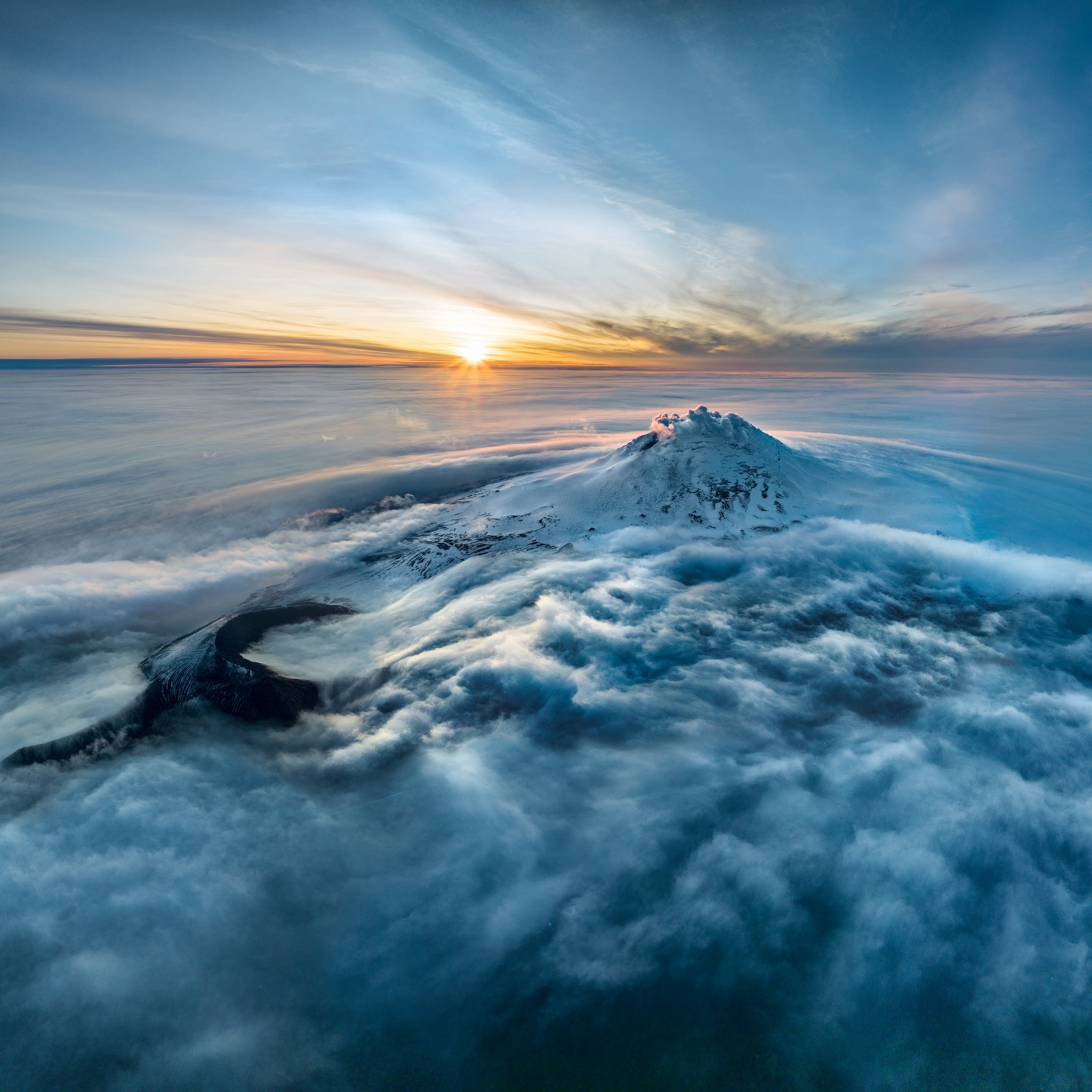
In 2013, a team of scientists rocked geology fans when they reported that Mauna Loa, a 2,000-square-mile shield volcano in Hawaii, was probably not in fact the largest volcano in the world. That accolade, the team suggested, belonged to Tamu Massif, an extinct volcanic mountain on the seafloor east of Japan that appeared to be a single shield volcano covering a whopping 100,000 square miles, roughly the same size as the state of Arizona.
But now, a study in Nature Geoscience has re-examined Tamu Massif and come to a very different conclusion: It’s not a shield volcano at all, which means Mauna Loa wins back the crown. And in a twist, the lead author on both studies is the same person: William Sager, a marine geophysicist at the University of Houston.
“That’s awesome, because that’s how science should work,” says Bill Chadwick, a seafloor geologist at the NOAA Pacific Marine Environmental Laboratory in Oregon who was not involved with the study. “You go with what the evidence is telling you, regardless of the fact that it contradicts something you believed before.”
Sager agrees, noting that his team’s revised look at the massive undersea structure reveals it may instead be a colossal pileup of oceanic crust that currently cannot be adequately explained, something perhaps even stranger than a singular giant volcano.
In essence, he says, Tamu Massif “is still extraordinary, even if we can’t claim the superlative.”
Go big or go home
Sager started studying Tamu Massif more than 25 years ago, long before he gave it its name. The structure sits deep within the northwest Pacific Ocean on the Shatsky Rise, which is something known as an oceanic plateau.
One theory states that these elevated, thick volcanic floors are the ocean equivalent of continental flood basalts—the product of giant and prolonged outpourings of lava. The idea is that the head of a superheated plume of mantle rock rises, decompresses, melts, and triggers massive amounts of magma generation in the crust, be that on land or on the seafloor.
Several papers in the 1990s including one coauthored by Sager, expounded and supported the idea of the mantle plume model for creating Shatsky Rise and Tamu Massif. In 2009, Sager and the International Ocean Discovery Program drilled into it at several points and found solidified lava flows up to 75 feet thick, suggesting that this massif was indeed formed by ginormous eruptions.
Seismic cross-sections taken soon after appeared to show all those rivers of lava coming from one single source. To the team, it really looked as if Tamu Massif was one giant shield volcano—a type of volcano usually made as fluid lava erupts and accumulates in layers, creating a domed structure that resembles a giant, rocky shield. In that case, Tamu Massif would be the world’s biggest shield volcano, a notion that really sold the study to Nature Geoscience at the time, Sager says.
Massif improvements
Once the paper appeared, the resulting media frenzy meant that plenty of people read about their 2013 research, something that was certainly welcome, Sager says.
“There were some things that always bothered me about it, though,” he says. In particular, something funny seemed to be going on with its magnetic signatures.
Tamu Massif happens to sit at the rendezvous point of three ocean ridges. Here, the magma bubbles up, solidifies into new crust, and moves outward from the ridge. Crucially, as new crust forms at these ridges, it records a snapshot of Earth’s global magnetic field.


Every now and then, Earth’s magnetic field flips, and these so-called reversals are recorded as a barcode-like pattern on the seafloor. Assuming the manner and rate of crust production is somewhat stable over time, the barcode segments will be fairly orderly, something the chaotic growth of a mantle plume-driven undersea volcano would lack.
It's easier to study volcanoes on other planets than it is under our own ocean.Janine Krippner, Smithsonian Institution Global Volcanism Program
Another comparatively smaller mountain, Ori Massif, sits near Tamu Massif. This one has that magnetic barcode pattern going right through it, a strong sign that it was created by magma extruding itself out of ocean ridges.
By contrast, the magnetic signature datasets for Tamu Massif were not great, but thanks to the huge press garnered by their 2013 paper, Sager acquired private funding to follow up on their work by mapping out Tamu Massif’s magnetic stripes in unprecedented detail. And even though the stripes in the middle had likely been contorted by a ridge segment that rotated over time, the maps clearly revealed a giant zebra crossing of magnetic stripes running across the massif.
That means Tamu Massif isn’t really a shield volcano. In actuality, it appears to be a colossal collection of 19-mile-thick oceanic crust, which is four times thicker than the global average. It’s not yet clear how this is possible, but it does suggest that the rate of crust production here was off the charts, again for currently unexplained reasons.
The entire Shatsky Rise is also covered in those telltale magnetic stripes, which implies that oceanic plateaus themselves are not submarine versions of continental flood basalts, and they aren’t driven by mantle plumes. Instead, they are forged through what Sager refers to as an augmented type of seafloor spreading.
In retrospect, Sager says that the 2013 study, made from just a handful of seismic profiles and samples, was a bit “like trying to put together a new dinosaur from a tooth and a thigh bone.”
The comeback queen
NOAA’s Chadwick, who was unconvinced by the 2013 paper, thinks that the authors are on the right track with the new work, citing their compelling magnetic data.
But Ken Rubin, a geochemist and volcanologist at the University of Hawaii at Manoa, still isn’t sold. He says the hard data to test the shield volcano model, the enhanced ridge volcanism model, or any other model at that rate, “are extremely sparse, still to this day.”
However, getting better data is easier said than done. Compared to their terrestrial cousins, studying underwater volcanic features is incredibly troublesome and rife with logistical difficulties; you can’t simply walk over it and take samples from wherever you wish, and you often largely rely on indirect observations. It’s supremely difficult to even spot underwater volcanic features in the first place, the majority of which are yet to be discovered.
“It's easier to study volcanoes on other planets than it is under our own ocean,” says Janine Krippner of the Smithsonian Institution’s Global Volcanism Program.
Until we know much more about the dimensions, distributions, and origins of the lava flows, and until more geophysical imaging is conducted to resolve the underlying structures, Rubin suspects that ideas about the origins of Tamu Massif and Shatsky Rise will remain mostly speculative and hypothetical.
And in the meantime, Mauna Loa will reign supreme as our planet’s most massive standalone volcano.
Related Topics
You May Also Like


Go Further
Animals
- This ‘saber-toothed’ salmon wasn’t quite what we thoughtThis ‘saber-toothed’ salmon wasn’t quite what we thought
- Why this rhino-zebra friendship makes perfect senseWhy this rhino-zebra friendship makes perfect sense
- When did bioluminescence evolve? It’s older than we thought.When did bioluminescence evolve? It’s older than we thought.
- Soy, skim … spider. Are any of these technically milk?Soy, skim … spider. Are any of these technically milk?
- This pristine piece of the Amazon shows nature’s resilienceThis pristine piece of the Amazon shows nature’s resilience
Environment
- This pristine piece of the Amazon shows nature’s resilienceThis pristine piece of the Amazon shows nature’s resilience
- Listen to 30 years of climate change transformed into haunting musicListen to 30 years of climate change transformed into haunting music
- This ancient society tried to stop El Niño—with child sacrificeThis ancient society tried to stop El Niño—with child sacrifice
- U.S. plans to clean its drinking water. What does that mean?U.S. plans to clean its drinking water. What does that mean?
History & Culture
- Séances at the White House? Why these first ladies turned to the occultSéances at the White House? Why these first ladies turned to the occult
- Gambling is everywhere now. When is that a problem?Gambling is everywhere now. When is that a problem?
- Beauty is pain—at least it was in 17th-century SpainBeauty is pain—at least it was in 17th-century Spain
- The real spies who inspired ‘The Ministry of Ungentlemanly Warfare’The real spies who inspired ‘The Ministry of Ungentlemanly Warfare’
- Heard of Zoroastrianism? The religion still has fervent followersHeard of Zoroastrianism? The religion still has fervent followers
Science
- Here's how astronomers found one of the rarest phenomenons in spaceHere's how astronomers found one of the rarest phenomenons in space
- Not an extrovert or introvert? There’s a word for that.Not an extrovert or introvert? There’s a word for that.
- NASA has a plan to clean up space junk—but is going green enough?NASA has a plan to clean up space junk—but is going green enough?
- Soy, skim … spider. Are any of these technically milk?Soy, skim … spider. Are any of these technically milk?
- Can aspirin help protect against colorectal cancers?Can aspirin help protect against colorectal cancers?
Travel
- What it's like to hike the Camino del Mayab in MexicoWhat it's like to hike the Camino del Mayab in Mexico
- Is this small English town Yorkshire's culinary capital?Is this small English town Yorkshire's culinary capital?
- This chef is taking Indian cuisine in a bold new directionThis chef is taking Indian cuisine in a bold new direction
- Follow in the footsteps of Robin Hood in Sherwood ForestFollow in the footsteps of Robin Hood in Sherwood Forest
