
Indonesia's giant capital city is sinking. Can the government's plan save it?
Indonesia has grand plans for Jakarta—a new capital on Borneo, a giant bird-shaped sea wall to protect Jakarta itself—but they don’t solve the underlying problem.
Jakarta — Apart from the narrow, unpaved road, the two-meter-high concrete coastal wall is the only thing that separates Suhemi’s small restaurant in North Jakarta from the sea. Her family depends on that wall. Growing up here in the Muara Baru neighborhood in the 80s and 90s, Suhemi used to play on the beach in front of her house. But by the 2000s the beach had disappeared, and the sea frequently inundated the neighborhood.
In 2002, the government built the coastal wall, to give the residents peace of mind and time—a respite from the steady sinking of the land under the city and the steady rising of the sea. But just five years later, in 2007, the wall proved no match for the worst floods in Jakarta’s modern history. Driven by a storm coming off the Java Sea and torrential rains, the floods claimed 80 lives around the city and caused hundreds of millions of dollars of damage.
In Muara Baru, the storm surge collapsed the wall, and the sea flooded Suhemi’s house.
“The water reached more than one meter,” she recalls. “My father almost died after being swept by the current. He survived after holding on to a door frame. He’s still traumatized.”
Today a lot of Jakartans live with the constant threat of another trauma like 2007; some areas, less protected even than Muara Baru, live with chronic flooding. The situation is one reason the government of President Joko Widodo announced in 2019 that it would move the nation’s capital away from its largest city, off the crowded island of Java to a new city to be built on Borneo, on land that is now forest. Construction is to begin this summer.


But as the government leaves the sinking capital, what is to become of the 10 million people like Suhemi who still live there?
The coastal wall is being extended, and there are grand plans for a giant artificial island in Jakarta Bay—but the funding for these schemes remains uncertain. And the fundamental cause of the sinking—the lack of an adequate public water supply, which has led to massive over-extraction of groundwater—remains mostly unaddressed.
The 2007 flood destroyed Suhemi’s home and small restaurant, her family’s sole means of support. The family sold two motorcycles to start over, and to resume serving rice with fried fish and chicken to the crews of fishing boats docked at the nearby port.
But the land has subsided significantly since 2007. The sea reaches almost to the top of the coastal wall now. If it were to breach the wall today, Suhemi imagines, water could flood the entire restaurant up to its ceiling.
“The road here is always muddy,” she says, pointing out a visible crack in the wall. Dirty blackish water is seeping through it. “We’ve made drainage so that the water will not inundate the road, but still it’s always wet.”
A problem with deep roots


For hundreds of years, flooding has been one of Jakarta’s biggest problems. The city, a major port, sits on a delta: Thirteen rivers flow through it on their way to Jakarta Bay from mountains to the south. The delta used to be lined with thick mangroves that provided a buffer against storm tides. Most of the mangroves were cut down long ago.
When the Dutch colonized Indonesia in 1619, they began transforming the city to make it resemble a typical Dutch town, with modern buildings and canals.The canals were meant to regulate the flow and to control flooding, but researchers argue that they exacerbated the underlying problem. The alluvial soil of the delta naturally compacts over time, causing the land surface to subside unless it is continually replenished with new sediment from overflowing rivers. The canals tended to prevent that.
“Sunda Kelapa, as it was called before the Dutch came, was once an organic and resilient community,” says Bosman Batubara, a doctoral candidate at University of Amsterdam and IHE Delft Institute for Water Education. “Building canals only made things worse because they tend to trap sediments.”
In recent years, the provincial government has engineered the rivers, clearing slums, building concrete levees, and dredging frequently, much as the Dutch did back in colonial days. With all that, the rivers still flood some parts of the capital—without building up the land, since it is mostly paved.
Jakarta is now sinking at a truly alarming rate—a rate that varies around the city but is up to 11 inches a year in the northern areas. About 40 percent of Jakarta is below sea level.
By comparison, climate change is raising sea level by only a fraction of an inch a year. But sinking land and rising sea both point toward the same outcome: regular flooding in a major capital city, a city with the most shopping malls in the world, currently ranked 12th for number of skyscrapers.
“Jakarta is the go-to city for all things,” says Hendricus Andy Simarmata, a lecturer at the Urban Planning Department at the University of Indonesia. “It’s the center of administration, the center of the economy, culture, and entertainment. Over the years Jakarta has grown uncontrollably into a megacity with no environmental support system.”
Ultimately that’s why it is sinking today.


Jakarta needs water
In 2007, after the catastrophic flood, the provincial government adopted a regulation requiring at least 30 percent of the city’s total area to be allocated to green, open space. More green space is not just a matter of general well-being. It’s also needed to absorb floods driven by torrential rains—and to funnel them into recharging the city’s depleted groundwater aquifers. Less than 10 percent of the city is green today.
Massive groundwater extraction is one of the main drivers of land subsidence in Jakarta, a sprawling concrete labyrinth that’s not supported by a reliable water supply network. Jakarta’s piped-water system serves fewer than one million households, a little over a quarter of the city’s total. The rest rely primarily on pumping groundwater.
While such pumping is not illegal, it is subject to taxation. But the provincial government is unable to monitor and tax the untold numbers of unregulated deep wells scattered across the city, mostly hidden behind closed doors.
Batubara, who has spent years researching the cause of Jakarta flooding, says the number of deep wells has ballooned with the city’s population, rising from fewer than 400 in 1968 to more than 3,600 in 1998. No one knows how many wells there are today, he says, but it’s presumably much higher.
The provincial government says groundwater consumption reached more than 8 million cubic meters in 2018, the last year for which it has provided data. In 2016 it estimated that Jakarta had reserves of 852 million cubic meters. Independent researchers estimated in 2011, however, that Jakarta had already used an alarming 64 percent of its groundwater reserves. With little open space, groundwater is simply not being replenished. Rains run off to the sea.
Last year the provincial governor’s office announced a ban on groundwater extraction by owners of buildings larger than 5,000 square meters (about 54,000 square feet). The ban is set to take effect in August 2023. Jakarta Governor Anies Baswedan has stated that by 2030, the piped-water network will supply the entire city. That would require a massive expansion of the existing network—and so far there is no sign of that happening on the required scale.
In coastal areas like North Jakarta, where there is no piped water readily available today, residents drill wells as deep as 150 meters, or around 500 feet. “If you drill less than 50 meters, all you get is saline water,” says Arti Astati, the community leader in the neighborhood of Muara Angke. One deep well can serve 50 households.
The alternative is to buy water in 40-liter jerrycans, which are sold from pushcarts by distributors who pump it from wells elsewhere in Jakarta. A typical family of four making less than $7 per day could easily spend a fifth of that on water, Astati says.
Last February, residents of Muara Angke held a demonstration in front of the Jakarta governor’s office, demanding access to tap water. “We have to wait for the rain if we want to take a shower and to wash clothes,” said one of the protesters.

Grand plans
In recent years Jakarta has become an electoral battleground; its governorship has become a stepping stone to the national presidency. Environmental issues are never absent during the campaign. Gubernatorial candidates always promise to fix Jakarta—the chronic traffic and choking air pollution as well as the acute flooding.


But Jakarta can’t be fixed during one governor’s tenure. Years go by, governors come and go, and the problems persist.
Since 2014, the national and provincial governments have been working in partnership on a plan to defend the coast of Jakarta against the encroaching sea. Revised several times, the mega-project is currently organized in two phases.
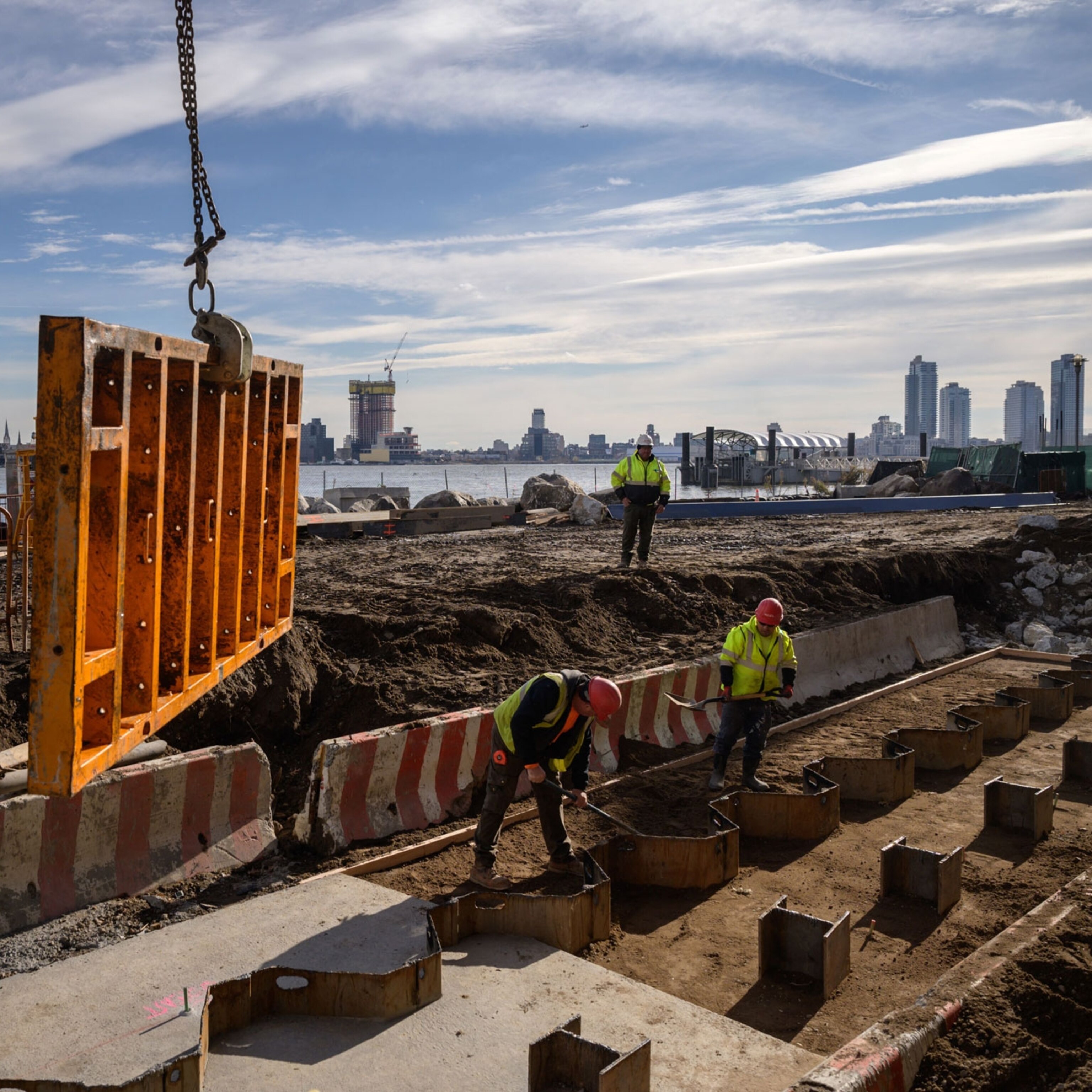
The first is the construction of a 29-mile-long wall along the coast. About eight miles have already been built, and construction is expected to go into high gear in 2023. The wall outside Suhemi’s house is an early piece of the project—but as her experience illustrates, the coastal wall is at best a temporary solution.
In the second phase of the mega project, a “Giant Sea Wall” is to be constructed offshore in Jakarta Bay. It’s to include a 20-mile long artificial island in the shape of a bird—the Garuda, Indonesia’s national symbol. The 10,000-acre island will block storm surges, but it is also supposed to house offices and apartments, a water reservoir, highways and train tracks, as well as recreational facilities.
Critics say the Giant Sea Wall would obstruct the flow of the 13 rivers, turning Jakarta Bay into a giant pool of sewage. And since the whole mega-project fails to address the cause of land subsidence, it will eventually sink, says Parid Ridwanuddin, a sea and coastal campaign manager at the Indonesia Environmental Forum (Walhi). He thinks the government should focus more on rejuvenating coastal areas by replanting mangroves and by restoring riverbanks crowded with housing to a more natural state.
“Mangrove formations have decreased considerably over the decades,” Ridwanuddin says, from 2,700 acres to around 60 today. The government’s strategy, he says, including the Giant Sea Wall, is “a temporary solution for a long term problem. It’s just another expensive project.”
So expensive in fact—the total cost has been variously estimated from $20 billion to $58 billion—that its future remains unclear. The provincial government has yet to find enough funding to complete its portion of the project, the wall along the coast.
The Giant Sea Wall is still in the design stage. The Netherlands and South Korea have promised a total of about $18 million between them for design and feasibility studies. But where the funding for construction will come from isn’t known, nor has the government announced a date for it to begin.

When the government goes...
Construction of the new capital city on Borneo, on the other hand, is supposed to begin this year and to be finished by 2045.
The national government wants it to be a “global city for all,” a smart, green city that acts as a hub for industry, businesses, and education. The $35 billion projected cost is to be financed by the national budget, state-owned enterprises, and private investors. According to the government, the United Arab Emirates, China, and South Korea have expressed interest in investing.
But local indigenous communities aren’t so happy with the plan. They fear the project would destroy their land, forest, and livelihoods. Protests have been frequent in the past year.
In Jakarta, on the other hand, some welcome the decision to move the seat of government to Borneo, arguing that it will ease Jakarta’s burdens of crowding and pollution. Simarmata, the urban planning researcher, thinks “Jakarta should undergo a strict dietary program, to give up some of its urban function and to give more space for green areas.” Moving the government would be a good start, he says.
Henny Warsilah, a researcher at the Center for Society and Culture of the National Research and Innovation Agency (BRIN), agrees.
“Jakarta will only lose its status as a capital,” he says. “But this will be a good chance to revitalize the city. The city already has some infrastructure to rise as a center for businesses or recreation.”
In contrast, Ridwanuddin sees the planned transfer of the capital as merely “moving the ecological crises to another location.”
“Jakarta is left to drown with no clear scheme for revitalizing it,” he says.
...some are left behind
The vulnerable communities along the northern coast of Jakarta couldn’t care less about the new capital city. For residents like Suhemi and Astati, relocating to a safer place is definitely not an option.
In Astati’s Muara Angke neighborhood, just a few yards from the Kali Adem port where tourists depart for the Thousand Islands, the coastal wall has not yet arrived.
“The flood occurs not monthly, or weekly, but on a daily basis,” she says. Sometimes the water rises thigh-deep, and when the forecast is bad, “I usually post a status or a message on a community WhatsApp group telling residents to be prepared.”
Earlier this year, the residents of Muara Angke took matters into their own hands: They used rubble to raise the road along the coast about one meter.
Some residents, including Astati, a 40-year-old who makes her living farming green mussels, also raised the yards and floors of their homes—with hundreds of kilograms of mussel shells. The shells are a cheap way to keep seawater out of the house, she says, and they allow it to drain quickly.
“All we want is to not be concerned about flooding anymore.”
You May Also Like


Go Further
Animals
- This ‘saber-toothed’ salmon wasn’t quite what we thoughtThis ‘saber-toothed’ salmon wasn’t quite what we thought
- Why this rhino-zebra friendship makes perfect senseWhy this rhino-zebra friendship makes perfect sense
- When did bioluminescence evolve? It’s older than we thought.When did bioluminescence evolve? It’s older than we thought.
- Soy, skim … spider. Are any of these technically milk?Soy, skim … spider. Are any of these technically milk?
- This pristine piece of the Amazon shows nature’s resilienceThis pristine piece of the Amazon shows nature’s resilience
Environment
- This pristine piece of the Amazon shows nature’s resilienceThis pristine piece of the Amazon shows nature’s resilience
- Listen to 30 years of climate change transformed into haunting musicListen to 30 years of climate change transformed into haunting music
- This ancient society tried to stop El Niño—with child sacrificeThis ancient society tried to stop El Niño—with child sacrifice
- U.S. plans to clean its drinking water. What does that mean?U.S. plans to clean its drinking water. What does that mean?
History & Culture
- Meet the original members of the tortured poets departmentMeet the original members of the tortured poets department
- Séances at the White House? Why these first ladies turned to the occultSéances at the White House? Why these first ladies turned to the occult
- Gambling is everywhere now. When is that a problem?Gambling is everywhere now. When is that a problem?
- Beauty is pain—at least it was in 17th-century SpainBeauty is pain—at least it was in 17th-century Spain
- The real spies who inspired ‘The Ministry of Ungentlemanly Warfare’The real spies who inspired ‘The Ministry of Ungentlemanly Warfare’
Science
- Here's how astronomers found one of the rarest phenomenons in spaceHere's how astronomers found one of the rarest phenomenons in space
- Not an extrovert or introvert? There’s a word for that.Not an extrovert or introvert? There’s a word for that.
- NASA has a plan to clean up space junk—but is going green enough?NASA has a plan to clean up space junk—but is going green enough?
- Soy, skim … spider. Are any of these technically milk?Soy, skim … spider. Are any of these technically milk?
Travel
- What it's like to hike the Camino del Mayab in MexicoWhat it's like to hike the Camino del Mayab in Mexico
- Is this small English town Yorkshire's culinary capital?Is this small English town Yorkshire's culinary capital?
- This chef is taking Indian cuisine in a bold new directionThis chef is taking Indian cuisine in a bold new direction
